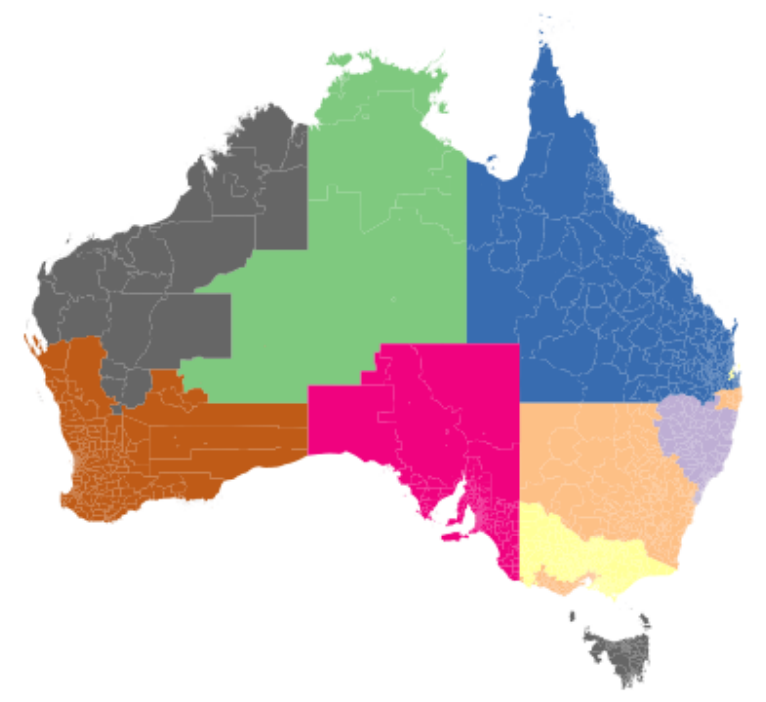
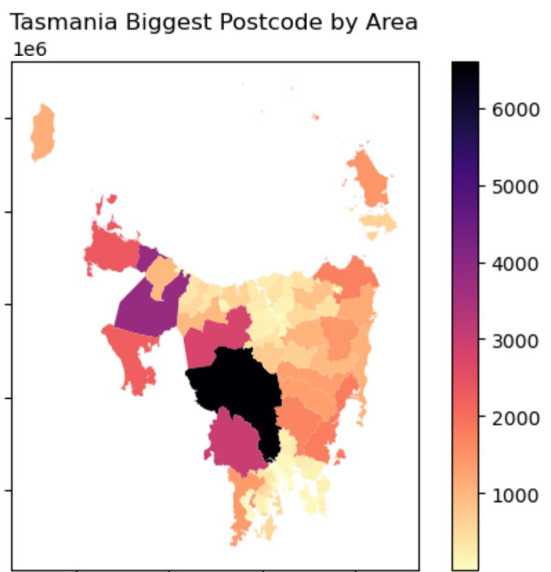
How Postcodes are distributed across Australia

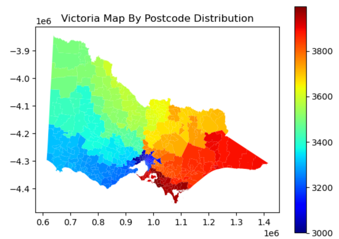
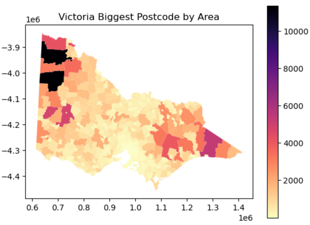
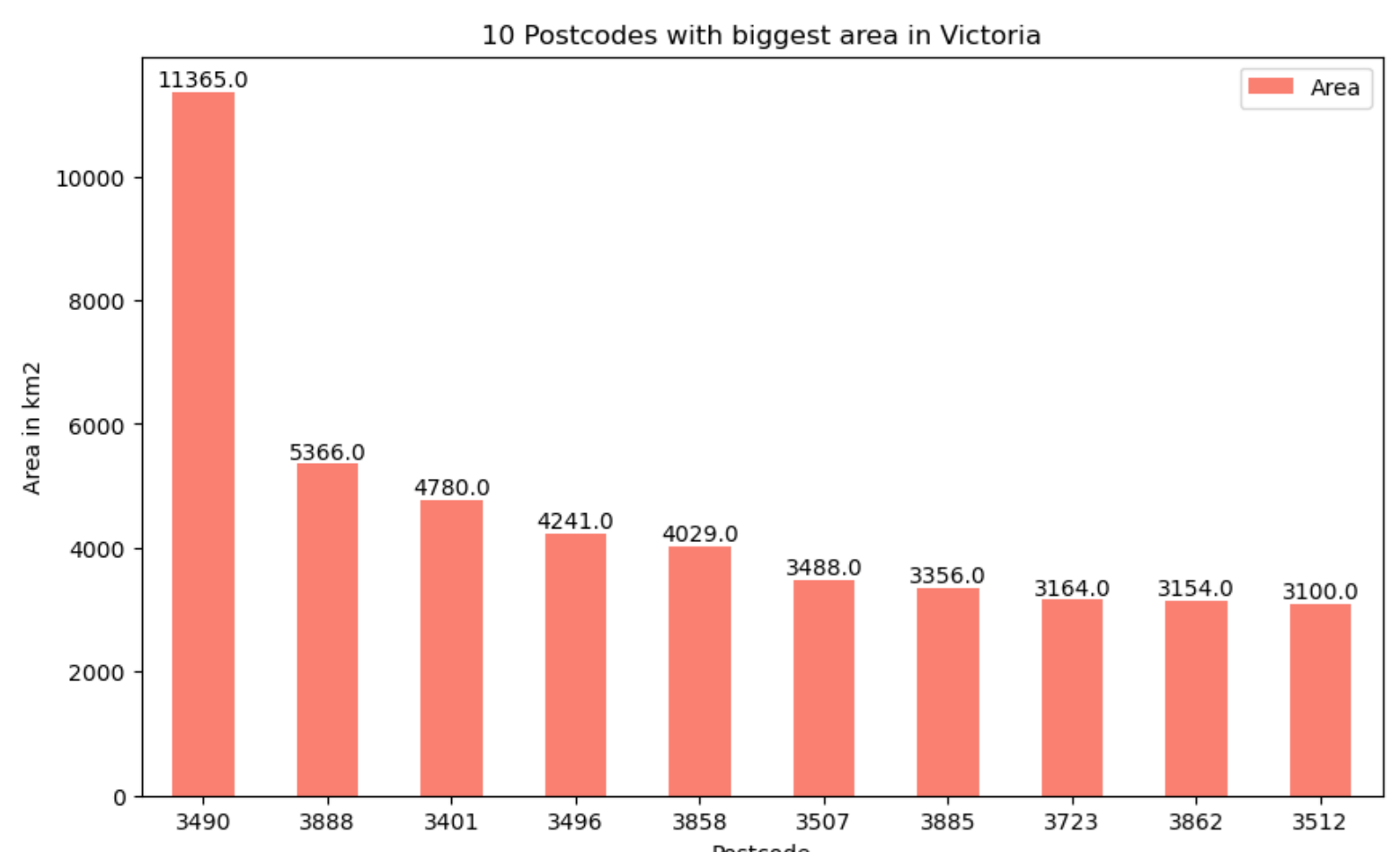
All maps have been generated using Python.

Map of Australia divided into regions with different colors, including green, blue, pink, orange, purple, yellow, and gray.
Color-coded map of Victoria, Australia, showing postal code distribution, with red indicating higher values and blue indicating lower values.
Map showing the Victorian postcode areas with the largest postcodes highlighted, with a color scale indicating postcode size, titled 'Victoria Biggest Postcode by Area'.
Bar graph titled '10 Postcodes with biggest area in Victoria' showing the area in square kilometers for ten postcodes. The biggest postcode is 3490 with an area of 11365 km2, followed by 3888 with 5366 km2, and 3401 with 4780 km2. The remaining postcodes have smaller areas, decreasing from around 4241 km2 to 3100 km2.
Map of Tasmania showing the largest postcode areas, with a color scale indicating population densities, with the highest density in the black region.
A map of New South Wales displaying postcode distribution with color gradients indicating varying postal code densities.